Geolocate

Mondarello topographic map

Click on the map to display elevation.

About this map

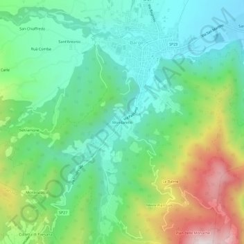
Name: Mondarello topographic map, elevation, terrain.

Location: Mondarello, Barge, Cuneo, Piemonte, 12032, Italia (44.69443 7.29770 44.73443 7.33770)

Average elevation: 550 m

Minimum elevation: 320 m

Maximum elevation: 1,055 m

Gear up for your next adventure:

🧢Outdoor Cap - Protective cap for sun and rain during hikes
🚲MTB Frame Bag - Carry tools and maps directly on your bicycle frame
🧶550 Survival Paracord - Versatile utility cord for emergency repairs and rigging
💧Filtered Water Bottle - Safe drinking water on the go
Lightweight Camping Tent - Portable shelter optimized for Canadian backcountry camping

As an Amazon Associate, this site earns from qualifying purchases at no extra cost to you.