Geolocate

Taloda topographic map

Click on the map to display elevation.

About this map

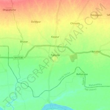
Name: Taloda topographic map, elevation, terrain.

Location: Taloda, Taloda Taluka, Nandurbar, Maharashtra, 425413, India (21.52277 74.17234 21.60277 74.25234)

Average elevation: 124 m

Minimum elevation: 95 m

Maximum elevation: 160 m

Gear up for your next adventure:

🧢Hiking Sun Hat - Wide-brimmed protection for exposed mountain ridges
🧥Softshell Hiking Jacket - The perfect balance of wind protection and breathability
💡LED Camping Lantern - Illuminate your campsite with long-lasting lanterns
🧭GPS Handheld Device - Reliable GPS navigation for outdoor adventures
🧤Rechargeable Heated Gloves - Extreme warmth for Canadian winter expeditions

As an Amazon Associate, this site earns from qualifying purchases at no extra cost to you.