

Penrose topographic map
Click on the map to display elevation.
About this map
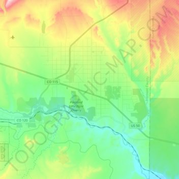
Name: Penrose topographic map, elevation, terrain.
Location: Penrose, Fremont County, Colorado, United States (38.33777 -105.06102 38.48550 -104.94073)
Average elevation: 1,629 m
Minimum elevation: 1,500 m
Maximum elevation: 1,883 m
Other topographic maps
Click on a map to view its topography, its elevation and its terrain.
Cañon City
United States > Colorado > Fremont County
The city's nickname, "the Climate Capital of Colorado", derives from the combination of unique geography and 5,300-foot (1,600 m) elevation protecting the city from harsh weather conditions. The average daily high temperature in January is 14 °F (7.8 °C) warmer in Cañon City than in Grand Junction, even…
Average elevation: 1,750 m