Geolocate

Maschere topographic map

Click on the map to display elevation.

About this map

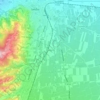
Name: Maschere topographic map, elevation, terrain.

Location: Maschere, Saluzzo, Cuneo, Piedmont, 12037, Italy (44.60829 7.48090 44.64829 7.52090)

Average elevation: 387 m

Minimum elevation: 321 m

Maximum elevation: 563 m

Gear up for your next adventure:

🐕Hiking Dog Pack - Let your canine companion carry their own water and food
🥾Trail Hiking Socks - Comfortable socks to prevent blisters and fatigue
🧰Survival Kit - Essential gear for emergencies in the wilderness
🧥Waterproof Jacket - Lightweight rain jackets for hiking and outdoor activities
🔦LED Flashlight - Powerful and long-lasting flashlight for camping and emergencies

As an Amazon Associate, this site earns from qualifying purchases at no extra cost to you.