
Thank you for supporting this site ❤️
Make a donation
Make a donation
Gear up for your next adventure:
As an Amazon Associate, this site earns from qualifying purchases at no extra cost to you.
Tipri topographic map
Click on the map to display elevation.
Thank you for supporting this site ❤️
Make a donation
Make a donation
Gear up for your next adventure:
As an Amazon Associate, this site earns from qualifying purchases at no extra cost to you.
About this map
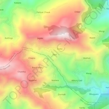
Name: Tipri topographic map, elevation, terrain.
Location: Tipri, Chinyali Saur, Uttarkashi, Uttarakhand, India (30.59191 78.26233 30.63191 78.30233)
Average elevation: 1,535 m
Minimum elevation: 1,015 m
Maximum elevation: 2,020 m
Thank you for supporting this site ❤️
Make a donation
Make a donation
Gear up for your next adventure:
As an Amazon Associate, this site earns from qualifying purchases at no extra cost to you.