Geolocate

Pinewoods topographic map

Click on the map to display elevation.

About this map

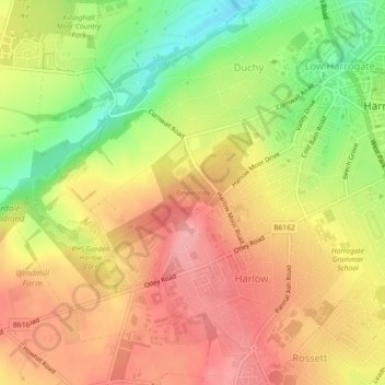
Name: Pinewoods topographic map, elevation, terrain.

Location: Pinewoods, Duchy, Harrogate, North Yorkshire, England, United Kingdom (53.98179 -1.57302 53.99030 -1.55542)

Average elevation: 139 m

Minimum elevation: 76 m

Maximum elevation: 184 m

Other topographic maps

Click on a map to view its topography, its elevation and its terrain.

Heyshaw

United Kingdom > England > North Yorkshire > Harrogate > Heyshaw

Average elevation: 221 m

Gear up for your next adventure:

👟Leg Gaiters - Keep debris, mud, and snow out of your boots
🔥Camping Stove - Portable stoves to cook outdoors with ease
🧣Merino Neck Gaiter - Protects against wind, sun, and cold at high altitudes
🧤Insulated Winter Gloves - Heavy-duty protection for sub-zero Canadian adventures
🥾Hiking Shoes - Durable and comfortable shoes for trail hiking

As an Amazon Associate, this site earns from qualifying purchases at no extra cost to you.