
Thank you for supporting this site ❤️
Make a donation
Make a donation
Gear up for your next adventure:
As an Amazon Associate, this site earns from qualifying purchases at no extra cost to you.
Núi Pha Luông topographic map
Click on the map to display elevation.
Thank you for supporting this site ❤️
Make a donation
Make a donation
Gear up for your next adventure:
As an Amazon Associate, this site earns from qualifying purchases at no extra cost to you.
About this map
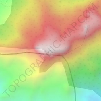
Name: Núi Pha Luông topographic map, elevation, terrain.
Location: Núi Pha Luông, Mộc Châu District, Sơn La Province, Vietnam (20.67268 104.63457 20.67278 104.63467)
Average elevation: 1,399 m
Minimum elevation: 788 m
Maximum elevation: 1,865 m
Thank you for supporting this site ❤️
Make a donation
Make a donation
Gear up for your next adventure:
As an Amazon Associate, this site earns from qualifying purchases at no extra cost to you.