Geolocate

Batan topographic map

Click on the map to display elevation.

About this map

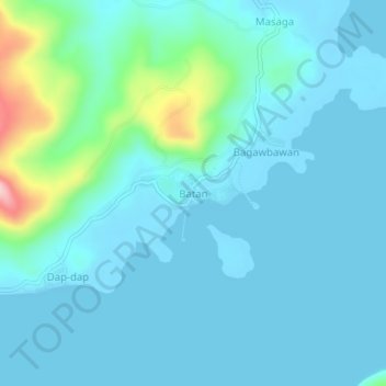
Name: Batan topographic map, elevation, terrain.

Location: Batan, Rapu-Rapu, Albay, Bicol Region, Philippines (13.20922 124.02877 13.24922 124.06877)

Average elevation: 29 m

Minimum elevation: -3 m

Maximum elevation: 208 m

Gear up for your next adventure:

🗺️Topographic Maps - Detailed maps to explore trails, mountains, and wilderness areas
🧊Insulated Water Bottle - Keeps drinks cold in summer and prevents freezing in winter
🧤Thermal Hiking Gloves - Grip-enhanced gloves for cold-weather altitude trekking
💡Portable Camping Lamp - Rechargeable lamp for campsite lighting
🩹Compact First Aid Kit - Pre-packed essentials for common trail injuries

As an Amazon Associate, this site earns from qualifying purchases at no extra cost to you.