Geolocate

Baru Sahib topographic map

Click on the map to display elevation.

About this map

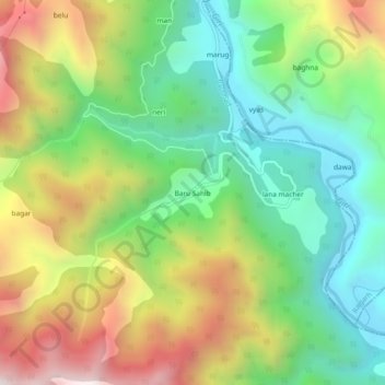
Name: Baru Sahib topographic map, elevation, terrain.

Location: Baru Sahib, Pachhad, Sirmaur, Himachal Pradesh, India (30.73488 77.27572 30.77488 77.31572)

Average elevation: 1,182 m

Minimum elevation: 751 m

Maximum elevation: 1,841 m

Gear up for your next adventure:

🥾Waterproof Hiking Boots - Boots keeping your feet dry in wet conditions
🍽️Titanium Camping Spork - Ultralight and indestructible eating utensil
🔥Camping Stove - Portable stoves to cook outdoors with ease
🎒Hiking Daypack - Lightweight and durable backpacks for day trips and excursions
🧶550 Survival Paracord - Versatile utility cord for emergency repairs and rigging

As an Amazon Associate, this site earns from qualifying purchases at no extra cost to you.