
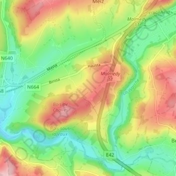
Wavreumont topographic map
Interactive map
Click on the map to display elevation.
About this map
Name: Wavreumont topographic map, elevation, terrain.
Location: Wavreumont, Stavelot, Verviers, Liège, Wallonie, 4970, Belgique (50.38349 5.95932 50.42349 5.99932)
Average elevation: 359 m
Minimum elevation: 279 m
Maximum elevation: 466 m
Other topographic maps
Click on a map to view its topography, its elevation and its terrain.
Francorchamps
Belgique > Liège > Verviers > Stavelot
Francorchamps, Stavelot, Verviers, Liège, Wallonie, 4970, Belgique
Average elevation: 482 m