Geolocate

Kirkvollen topographic map

Click on the map to display elevation.

About this map

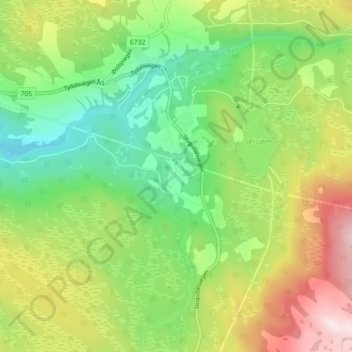
Name: Kirkvollen topographic map, elevation, terrain.

Location: Kirkvollen, Ås, Tydal, Trøndelag, Norway (63.01411 11.65685 63.05411 11.69685)

Average elevation: 517 m

Minimum elevation: 351 m

Maximum elevation: 774 m

Gear up for your next adventure:

🥘Camping Cookware Set - Compact nesting pots and pans for trail cooking
🥾Lightweight Hiking Shoes - Comfortable shoes for day hikes
🔦UV Flashlight - Detect minerals or specific insects in the dark
👖Convertible Hiking Pants - Zip-off legs to adapt to changing weather conditions
🧥Softshell Jacket - Windproof and breathable jacket for hiking

As an Amazon Associate, this site earns from qualifying purchases at no extra cost to you.