
Graton topographic map
Click on the map to display elevation.
Graton
Graton is located at the southeastern end of Green Valley, on the east bank of the seasonally flooding Atascadero Creek. The elevation ranges from approximately 85 feet (26 m) above Mean Sea Level (MSL) at Atascadero Creek to 213 feet (65 m) MSL at Oak Grove School.
About this map
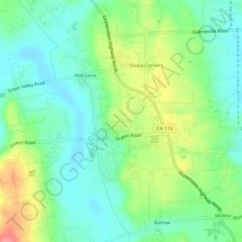
Name: Graton topographic map, elevation, terrain.
Location: Graton, Sonoma County, California, 95444, United States (38.42220 -122.87740 38.45507 -122.85053)
Average elevation: 50 m
Minimum elevation: 20 m
Maximum elevation: 110 m