
Thank you for supporting this site ❤️
Make a donation
Make a donation
Gear up for your next adventure:
As an Amazon Associate, this site earns from qualifying purchases at no extra cost to you.
Saint-Genest-Malifaux topographic map
Click on the map to display elevation.
Thank you for supporting this site ❤️
Make a donation
Make a donation
Gear up for your next adventure:
As an Amazon Associate, this site earns from qualifying purchases at no extra cost to you.
About this map
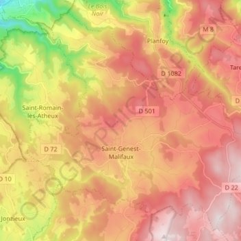
Name: Saint-Genest-Malifaux topographic map, elevation, terrain.
Average elevation: 959 m
Minimum elevation: 551 m
Maximum elevation: 1,246 m
Thank you for supporting this site ❤️
Make a donation
Make a donation
Gear up for your next adventure:
As an Amazon Associate, this site earns from qualifying purchases at no extra cost to you.
Other topographic maps
Click on a map to view its topography, its elevation and its terrain.
La Maranche
France > Auvergne-Rhône-Alpes > Loire > Saint-Bonnet-le-Courreau > La Maranche
Average elevation: 894 m