
Unha topographic map
Interactive map
Click on the map to display elevation.
About this map
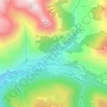
Name: Unha topographic map, elevation, terrain.
Location: Unha, Salardú, Naut Aran, Val d'Aran, Catalonië, 25599, Spanje (42.69017 0.88207 42.73017 0.92207)
Average elevation: 1,596 m
Minimum elevation: 1,149 m
Maximum elevation: 2,281 m