
Schoorl topographic map
Interactive map
Click on the map to display elevation.
About this map
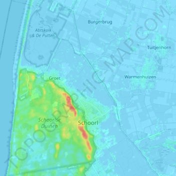
Name: Schoorl topographic map, elevation, terrain.
Location: Schoorl, Bergen (NH), Holanda Septentrional, Países Bajos (52.67564 4.61546 52.75833 4.72524)
Average elevation: 3 m
Minimum elevation: -4 m
Maximum elevation: 44 m
Other topographic maps
Click on a map to view its topography, its elevation and its terrain.
Bergen (NH)
Países Bajos > Holanda Septentrional > Bergen (NH)
Bergen (NH), Holanda Septentrional, Países Bajos
Average elevation: 4 m