Geolocate

Monte Narbone topographic map

Click on the map to display elevation.

About this map

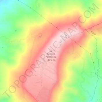
Name: Monte Narbone topographic map, elevation, terrain.

Location: Monte Narbone, Agrigento, Sicily, 92100, Italy (37.22939 13.72239 37.22949 13.72249)

Average elevation: 302 m

Minimum elevation: 122 m

Maximum elevation: 438 m

Gear up for your next adventure:

🦯Trekking Poles - Reduced impact on joints for steep topographic climbs
🍽️Titanium Camping Spork - Ultralight and indestructible eating utensil
🥾Mountaineering Boots - Supportive boots for climbing and high-altitude hiking
Camping Tent - Weather-resistant tents suitable for 2 to 6 people
🧭GPS Outdoor Watch - Smart watch for navigation and fitness tracking in nature

As an Amazon Associate, this site earns from qualifying purchases at no extra cost to you.