Geolocate

Pajangan topographic map

Click on the map to display elevation.

About this map

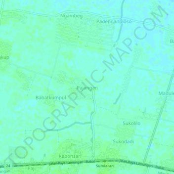
Name: Pajangan topographic map, elevation, terrain.

Location: Pajangan, Lamongan, East Java, Java, 62257, Indonesia (-7.09673 112.29792 -7.05673 112.33792)

Average elevation: 6 m

Minimum elevation: 2 m

Maximum elevation: 9 m

Other topographic maps

Click on a map to view its topography, its elevation and its terrain.

Bluluk

Indonesia > East Java > Lamongan

Average elevation: 73 m

Sukorame

Indonesia > East Java > Lamongan

Average elevation: 101 m

Jejel

Indonesia > East Java > Lamongan > Ngimbang

Average elevation: 80 m

Wonorejo

Indonesia > East Java > Lamongan > Sambeng

Average elevation: 81 m

Ngimbang

Indonesia > East Java > Lamongan

Average elevation: 89 m

Pamotan

Indonesia > East Java > Lamongan > Sambeng

Average elevation: 78 m

Garung

Indonesia > East Java > Lamongan > Sambeng

Average elevation: 76 m

Sambeng

Indonesia > East Java > Lamongan

Average elevation: 79 m

Pataan

Indonesia > East Java > Lamongan > Sambeng

Average elevation: 102 m

Selorejo

Indonesia > East Java > Lamongan > Sambeng

Average elevation: 55 m

Gear up for your next adventure:

🥾Trail Hiking Boots - Supportive boots for rough trails
👖Convertible Hiking Pants - Zip-off legs to adapt to changing weather conditions
🧳Compression Sacks - Maximize space in your backpack by shrinking gear
🥾Hiking Shoes - Durable and comfortable shoes for trail hiking
🛰️Satellite Messenger - Emergency communication for areas with no cell service

As an Amazon Associate, this site earns from qualifying purchases at no extra cost to you.