
Garin topographic map
Interactive map
Click on the map to display elevation.
About this map
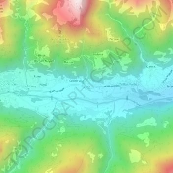
Name: Garin topographic map, elevation, terrain.
Location: Garin, Villar Pellice, Turin, Piémont, Italie (44.78731 7.12354 44.82731 7.16354)
Average elevation: 967 m
Minimum elevation: 608 m
Maximum elevation: 1,748 m