
Make a donation
Gear up for your next adventure:
As an Amazon Associate, this site earns from qualifying purchases at no extra cost to you.
USS Utah topographic map
Click on the map to display elevation.
Make a donation
Gear up for your next adventure:
As an Amazon Associate, this site earns from qualifying purchases at no extra cost to you.
About this map
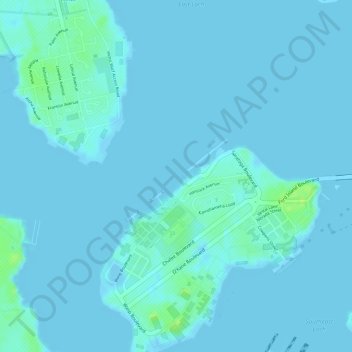
Name: USS Utah topographic map, elevation, terrain.
Location: USS Utah, Waipahu, Honolulu County, Hawaii, United States (21.36849 -157.96347 21.36933 -157.96181)
Average elevation: 2 m
Minimum elevation: -4 m
Maximum elevation: 13 m
Make a donation
Gear up for your next adventure:
As an Amazon Associate, this site earns from qualifying purchases at no extra cost to you.
Other topographic maps
Click on a map to view its topography, its elevation and its terrain.
Schofield Barracks
United States > Hawaii > Honolulu County > Waipahu
Schofield Barracks has a tropical savanna climate. Owing to a higher elevation, Schofield is slightly cooler year round than Honolulu, but is still well within the realms of a tropical climate. Precipitation patterns closely resemble those of mediterranean climates being found in mainland California, but its…
Average elevation: 279 m
Joint Base Pearl Harbor-Hickam
United States > Hawaii > Honolulu County > Waipahu
Average elevation: 7 m