
Vouèces topographic map
Interactive map
Click on the map to display elevation.
About this map
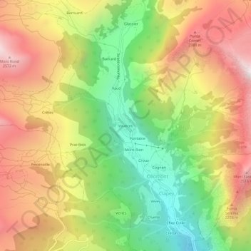
Name: Vouèces topographic map, elevation, terrain.
Location: Vouèces, Clapey, Ollomont, Vallée d'Aoste, Italie (45.83773 7.28331 45.87773 7.32331)
Average elevation: 1,911 m
Minimum elevation: 1,179 m
Maximum elevation: 2,657 m
Other topographic maps
Click on a map to view its topography, its elevation and its terrain.
Mont-Rion
Italie > Vallée d'Aoste > Clapey
Mont-Rion, Clapey, Ollomont, Vallée d'Aoste, Italie
Average elevation: 1,875 m