
Moucher topographic map
Interactive map
Click on the map to display elevation.
About this map
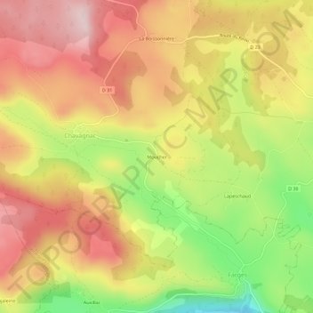
Name: Moucher topographic map, elevation, terrain.
Average elevation: 1,123 m
Minimum elevation: 943 m
Maximum elevation: 1,259 m
Other topographic maps
Click on a map to view its topography, its elevation and its terrain.
La Boissonnière
France > Auvergne-Rhône-Alpes > Cantal > Neussargues en Pinatelle > Chavagnac
La Boissonnière, Chavagnac, Neussargues en Pinatelle, Saint-Flour, Cantal, Auvergne-Rhône-Alpes, France métropolitaine, 15300, France
Average elevation: 1,141 m
Lac du Pêcher
France > Auvergne-Rhône-Alpes > Cantal > Neussargues en Pinatelle > Chavagnac
Lac du Pêcher, Chavagnac, Neussargues en Pinatelle, Saint-Flour, Cantal, Auvergne-Rhône-Alpes, France métropolitaine, 15300, France
Average elevation: 1,162 m