
Thank you for supporting this site ❤️
Make a donation
Make a donation
Gear up for your next adventure:
As an Amazon Associate, this site earns from qualifying purchases at no extra cost to you.
Cabuyaro topographic map
Click on the map to display elevation.
Thank you for supporting this site ❤️
Make a donation
Make a donation
Gear up for your next adventure:
As an Amazon Associate, this site earns from qualifying purchases at no extra cost to you.
About this map
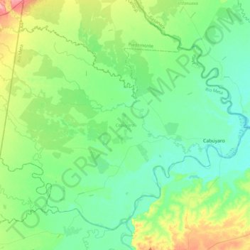
Name: Cabuyaro topographic map, elevation, terrain.
Location: Cabuyaro, Rio Meta, Meta, Orinoquia, Colombia (4.14984 -73.12414 4.47621 -72.73478)
Average elevation: 187 m
Minimum elevation: 160 m
Maximum elevation: 271 m
Thank you for supporting this site ❤️
Make a donation
Make a donation
Gear up for your next adventure:
As an Amazon Associate, this site earns from qualifying purchases at no extra cost to you.