
Make a donation
Gear up for your next adventure:
As an Amazon Associate, this site earns from qualifying purchases at no extra cost to you.
De Panne topographic map
Click on the map to display elevation.
Make a donation
Gear up for your next adventure:
As an Amazon Associate, this site earns from qualifying purchases at no extra cost to you.
De Panne
De Panne is gemakkelijk bereikbaar met de trein over de spoorlijn die eindigt bij station De Panne in Adinkerke, waarbij steeds een directe overstap op de kusttram mogelijk is aangezien de terminus ervan vlak aan het station ligt. Het treinstation is gelegen aan spoorlijn 73 ter hoogte van Adinkerke. Vanaf hier vertrekken er rechtstreekse treinen naar Antwerpen en Brussel via Gent Sint-Pieters.
Make a donation
Gear up for your next adventure:
As an Amazon Associate, this site earns from qualifying purchases at no extra cost to you.
About this map
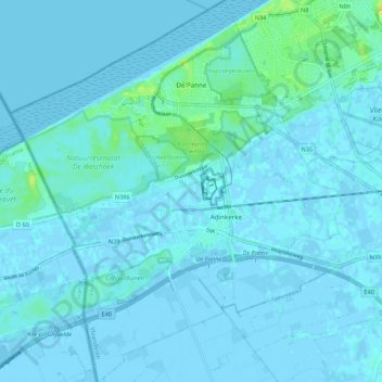
Name: De Panne topographic map, elevation, terrain.
Location: De Panne, Veurne, West-Vlaanderen, 8660, België (51.04617 2.54136 51.11378 2.63455)
Average elevation: 2 m
Minimum elevation: -7 m
Maximum elevation: 24 m
Make a donation
Gear up for your next adventure:
As an Amazon Associate, this site earns from qualifying purchases at no extra cost to you.
Other topographic maps
Click on a map to view its topography, its elevation and its terrain.
Hoge Blekker
België > West-Vlaanderen > Veurne > Koksijde > Koksijde-Dorp
Dit zogenaamd rijshout bestond oorspronkelijk uit gekapte duindoorn, later werd vooral snoeihout van de cultuurpopulier gebruikt. De tussenliggende zones werden bepoot met helmgras. Deze grassoort bezit het vermogen om bij overstuiving via verticale uitlopers van zijn wortels boven op het nieuw aangevoerde…
Average elevation: 6 m
Make a donation
Gear up for your next adventure:
As an Amazon Associate, this site earns from qualifying purchases at no extra cost to you.
Make a donation
Gear up for your next adventure:
As an Amazon Associate, this site earns from qualifying purchases at no extra cost to you.
Westhoekduinen, duinen van Cabour, De Moeren en plateau van Izenberge
België > West-Vlaanderen > Veurne > Veurne
Average elevation: 1 m
Make a donation
Gear up for your next adventure:
As an Amazon Associate, this site earns from qualifying purchases at no extra cost to you.
Make a donation
Gear up for your next adventure:
As an Amazon Associate, this site earns from qualifying purchases at no extra cost to you.