
Thank you for supporting this site ❤️
Make a donation
Make a donation
Gear up for your next adventure:
As an Amazon Associate, this site earns from qualifying purchases at no extra cost to you.
Lhalung topographic map
Click on the map to display elevation.
Thank you for supporting this site ❤️
Make a donation
Make a donation
Gear up for your next adventure:
As an Amazon Associate, this site earns from qualifying purchases at no extra cost to you.
About this map
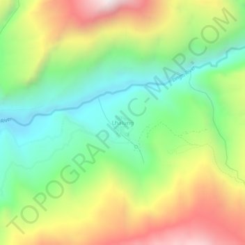
Name: Lhalung topographic map, elevation, terrain.
Location: Lhalung, Spiti, Lahaul and Spiti, Himachal Pradesh, Inde (32.12716 78.21389 32.16716 78.25389)
Average elevation: 4,054 m
Minimum elevation: 3,539 m
Maximum elevation: 4,811 m
Thank you for supporting this site ❤️
Make a donation
Make a donation
Gear up for your next adventure:
As an Amazon Associate, this site earns from qualifying purchases at no extra cost to you.
Other topographic maps
Click on a map to view its topography, its elevation and its terrain.