
Thank you for supporting this site ❤️
Make a donation
Make a donation
Gear up for your next adventure:
As an Amazon Associate, this site earns from qualifying purchases at no extra cost to you.
Agrelo topographic map
Click on the map to display elevation.
Thank you for supporting this site ❤️
Make a donation
Make a donation
Gear up for your next adventure:
As an Amazon Associate, this site earns from qualifying purchases at no extra cost to you.
About this map
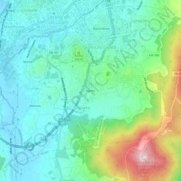
Name: Agrelo topographic map, elevation, terrain.
Location: Agrelo, Nogueira, Fraião e Lamaçães, Braga, 4715-210, Portugal (41.50948 -8.43066 41.54948 -8.39066)
Average elevation: 246 m
Minimum elevation: 138 m
Maximum elevation: 558 m
Thank you for supporting this site ❤️
Make a donation
Make a donation
Gear up for your next adventure:
As an Amazon Associate, this site earns from qualifying purchases at no extra cost to you.