Geolocate

Grevinge topographic map

Click on the map to display elevation.

About this map

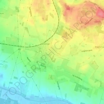
Name: Grevinge topographic map, elevation, terrain.

Location: Grevinge, Odsherred Municipality, Region Zealand, Denmark (55.79649 11.54417 55.80403 11.55943)

Average elevation: 37 m

Minimum elevation: -2 m

Maximum elevation: 81 m

Gear up for your next adventure:

🧥Packable Rain Jacket - Breathable waterproof layer for unpredictable weather
🎒Hiking Daypack - Lightweight and durable backpacks for day trips and excursions
🧤Rechargeable Heated Gloves - Extreme warmth for Canadian winter expeditions
🧼Travel Hand Sanitizer - Keep hands clean when water is scarce
🔭Outdoor Binoculars - Lightweight binoculars for birdwatching and hiking

As an Amazon Associate, this site earns from qualifying purchases at no extra cost to you.