Geolocate

Matagbac topographic map

Click on the map to display elevation.

About this map

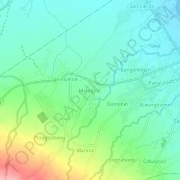
Name: Matagbac topographic map, elevation, terrain.

Location: Matagbac, Tabaco, Albay, Bicol Region, 4511, Philippines (13.33468 123.68732 13.37468 123.72732)

Average elevation: 36 m

Minimum elevation: 0 m

Maximum elevation: 128 m

Other topographic maps

Click on a map to view its topography, its elevation and its terrain.

Gear up for your next adventure:

🧴Insect Repellent - Protect yourself from bugs during outdoor adventures
🧦Outdoor Socks - Durable socks designed for hiking and outdoor sports
🧰Survival Kit - Essential gear for emergencies in the wilderness
Bushcraft Tarp - Versatile emergency shelter or gear protection
🧢Outdoor Cap - Protective cap for sun and rain during hikes

As an Amazon Associate, this site earns from qualifying purchases at no extra cost to you.