
Thank you for supporting this site ❤️
Make a donation
Make a donation
Gear up for your next adventure:
As an Amazon Associate, this site earns from qualifying purchases at no extra cost to you.
Borazjan topographic map
Click on the map to display elevation.
Thank you for supporting this site ❤️
Make a donation
Make a donation
Gear up for your next adventure:
As an Amazon Associate, this site earns from qualifying purchases at no extra cost to you.
About this map
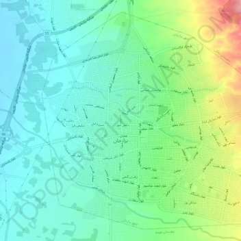
Name: Borazjan topographic map, elevation, terrain.
Location: Borazjan, بخش مرکزی, Dashtestan County, Bushehr Province, Iran (29.24679 51.19243 29.29400 51.25234)
Average elevation: 72 m
Minimum elevation: 34 m
Maximum elevation: 168 m
Thank you for supporting this site ❤️
Make a donation
Make a donation
Gear up for your next adventure:
As an Amazon Associate, this site earns from qualifying purchases at no extra cost to you.