Geolocate

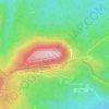
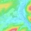
Rothau topographic map

Click on the map to display elevation.

About this map

Name: Rothau topographic map, elevation, terrain.

Location: Rothau, Molsheim, Bas-Rhin, Grand Est, Metropolitan France, 67570, France (48.43387 7.18764 48.47255 7.22184)

Average elevation: 487 m

Minimum elevation: 314 m

Maximum elevation: 737 m

Other topographic maps

Click on a map to view its topography, its elevation and its terrain.
le Champ du Feu

France > Grand Est > Bas-Rhin > Belmont

Average elevation: 945 m

Erstein-Gare

France > Grand Est > Bas-Rhin > Erstein

Average elevation: 154 m

Col du Donon

France > Grand Est > Bas-Rhin > Grandfontaine

Average elevation: 694 m

Graufthal

France > Grand Est > Bas-Rhin > Eschbourg

Average elevation: 290 m

2te Gewann Neufeld

France > Grand Est > Bas-Rhin > Offendorf

Average elevation: 127 m

Willigen

France > Grand Est > Bas-Rhin > Kilstett

Average elevation: 130 m

Grande Île

France > Grand Est > Bas-Rhin > Strasbourg

Average elevation: 145 m

Le Hang

France > Grand Est > Bas-Rhin > Bourg-Bruche

Average elevation: 580 m

Tête Pelée

France > Grand Est > Bas-Rhin > La Broque

Average elevation: 672 m

Su

France > Grand Est > Bas-Rhin > Soultz-les-Bains

Average elevation: 207 m

Kreutzel

France > Grand Est > Bas-Rhin > Baerendorf

Average elevation: 275 m

Gear up for your next adventure:

🦌Outdoor Trail Camera - Monitor wildlife activity near your favorite spots
🔦UV Flashlight - Detect minerals or specific insects in the dark
🧥Fleece Jacket - Warm and lightweight jacket for layering
🥾Approach Shoes - Shoes designed for climbing approaches and rugged trails
🧰Emergency Multi-Tool - Compact multi-tool for outdoor survival

As an Amazon Associate, this site earns from qualifying purchases at no extra cost to you.