
Thank you for supporting this site ❤️
Make a donation
Make a donation
Gear up for your next adventure:
As an Amazon Associate, this site earns from qualifying purchases at no extra cost to you.
trucha topographic map
Click on the map to display elevation.
Thank you for supporting this site ❤️
Make a donation
Make a donation
Gear up for your next adventure:
As an Amazon Associate, this site earns from qualifying purchases at no extra cost to you.
About this map
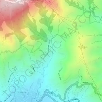
Name: trucha topographic map, elevation, terrain.
Location: trucha, Dosquebradas, Risaralda, Colombia (4.87004 -75.65216 4.87014 -75.65210)
Average elevation: 1,745 m
Minimum elevation: 1,499 m
Maximum elevation: 2,148 m
Thank you for supporting this site ❤️
Make a donation
Make a donation
Gear up for your next adventure:
As an Amazon Associate, this site earns from qualifying purchases at no extra cost to you.