Geolocate

Topsy topographic map

Click on the map to display elevation.

About this map

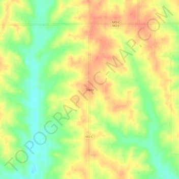
Name: Topsy topographic map, elevation, terrain.

Location: Topsy, Mercer County, Missouri, United States (40.33307 -93.49994 40.37307 -93.45994)

Average elevation: 304 m

Minimum elevation: 276 m

Maximum elevation: 325 m

Gear up for your next adventure:

🛶Canoe Life Vest - Safety vest for water sports
🥾Hiking Shorts - Breathable shorts suitable for summer hikes
🥾Waterproof Hiking Shoes - Durable shoes for wet and rugged trails
🧥Fleece Jacket - Warm and lightweight jacket for layering
🔪Outdoor Multitool - Versatile tool for repairs and food prep in the wild

As an Amazon Associate, this site earns from qualifying purchases at no extra cost to you.