
Thank you for supporting this site ❤️
Make a donation
Make a donation
Gear up for your next adventure:
As an Amazon Associate, this site earns from qualifying purchases at no extra cost to you.
Pazhathottam topographic map
Click on the map to display elevation.
Thank you for supporting this site ❤️
Make a donation
Make a donation
Gear up for your next adventure:
As an Amazon Associate, this site earns from qualifying purchases at no extra cost to you.
About this map
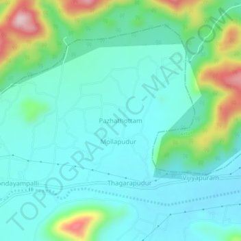
Name: Pazhathottam topographic map, elevation, terrain.
Location: Pazhathottam, Gangavalli, Salem, Tamil Nadu, India (11.44814 78.52281 11.48814 78.56281)
Average elevation: 313 m
Minimum elevation: 244 m
Maximum elevation: 551 m
Thank you for supporting this site ❤️
Make a donation
Make a donation
Gear up for your next adventure:
As an Amazon Associate, this site earns from qualifying purchases at no extra cost to you.