
Huddinge topographic map
Interactive map
Click on the map to display elevation.
About this map
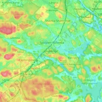
Name: Huddinge topographic map, elevation, terrain.
Location: Huddinge, Huddinge kommun, Stockholms län, 141 33, Zweden (59.18938 17.93488 59.26938 18.01488)
Average elevation: 46 m
Minimum elevation: 19 m
Maximum elevation: 90 m