
Thank you for supporting this site ❤️
Make a donation
Make a donation
Gear up for your next adventure:
As an Amazon Associate, this site earns from qualifying purchases at no extra cost to you.
Mohabbewāla topographic map
Click on the map to display elevation.
Thank you for supporting this site ❤️
Make a donation
Make a donation
Gear up for your next adventure:
As an Amazon Associate, this site earns from qualifying purchases at no extra cost to you.
About this map
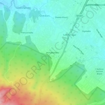
Name: Mohabbewāla topographic map, elevation, terrain.
Location: Mohabbewāla, Dehradun, Uttarakhand, 248001, India (30.25097 77.96265 30.29097 78.00265)
Average elevation: 626 m
Minimum elevation: 580 m
Maximum elevation: 739 m
Thank you for supporting this site ❤️
Make a donation
Make a donation
Gear up for your next adventure:
As an Amazon Associate, this site earns from qualifying purchases at no extra cost to you.