Geolocate

La Montera topographic map

Click on the map to display elevation.

About this map

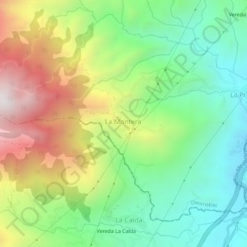
Name: La Montera topographic map, elevation, terrain.

Location: La Montera, Don Matías, Norte, Antioquia, Colombia (6.48643 -75.30511 6.52643 -75.26511)

Average elevation: 1,596 m

Minimum elevation: 1,123 m

Maximum elevation: 2,354 m

Gear up for your next adventure:

🧢Hiking Hat - Sun-protective and breathable hats for long treks
🧢Hiking Sun Hat - Wide-brimmed protection for exposed mountain ridges
🧳Compression Sacks - Maximize space in your backpack by shrinking gear
💡Compact LED Flashlight - Powerful and portable flashlight for outdoor use
Family Camping Tent - Spacious tent suitable for family camping trips

As an Amazon Associate, this site earns from qualifying purchases at no extra cost to you.