
Make a donation
Gear up for your next adventure:
As an Amazon Associate, this site earns from qualifying purchases at no extra cost to you.
Titz topographic map
Click on the map to display elevation.
Make a donation
Gear up for your next adventure:
As an Amazon Associate, this site earns from qualifying purchases at no extra cost to you.
Titz
Die Gemeinde Titz liegt in der Jülicher Börde. Im Süden befindet sich die Sophienhöhe. Östlich und nordöstlich der Gemeinde liegt der Braunkohletagebau Garzweiler.
Make a donation
Gear up for your next adventure:
As an Amazon Associate, this site earns from qualifying purchases at no extra cost to you.
About this map
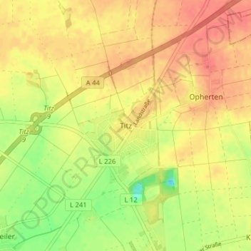
Name: Titz topographic map, elevation, terrain.
Location: Titz, Kreis Düren, Nordrhein-Westfalen, 52445, Deutschland (50.98752 6.40702 51.02752 6.44702)
Average elevation: 103 m
Minimum elevation: 71 m
Maximum elevation: 122 m
Make a donation
Gear up for your next adventure:
As an Amazon Associate, this site earns from qualifying purchases at no extra cost to you.