Geolocate

Bukit Raja topographic map

Click on the map to display elevation.

About this map

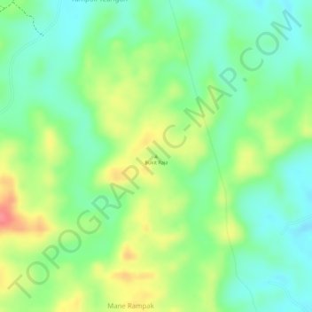
Name: Bukit Raja topographic map, elevation, terrain.

Location: Bukit Raja, Julok, Aceh Timur, Aceh, Sumatra, Indonesia (5.00625 97.59405 5.00635 97.59415)

Average elevation: 50 m

Minimum elevation: 16 m

Maximum elevation: 97 m

Other topographic maps

Click on a map to view its topography, its elevation and its terrain.

Peureulak

Indonesia > Aceh > Aceh Timur

Average elevation: 10 m

Peunaron

Indonesia > Aceh > Aceh Timur

Average elevation: 424 m

Sungai Raya

Indonesia > Aceh > Aceh Timur

Average elevation: 18 m

Gear up for your next adventure:

🧼Travel Hand Sanitizer - Keep hands clean when water is scarce
🧢Sun Hat - Wide-brim hat for sun protection
🧢Hiking Sun Hat - Wide-brimmed protection for exposed mountain ridges
🌡️Emergency Mylar Blankets - Compact thermal protection for unexpected nights outdoors
🥾Approach Shoes - Shoes designed for climbing approaches and rugged trails

As an Amazon Associate, this site earns from qualifying purchases at no extra cost to you.