Geolocate

Caltrano topographic map

Click on the map to display elevation.

About this map
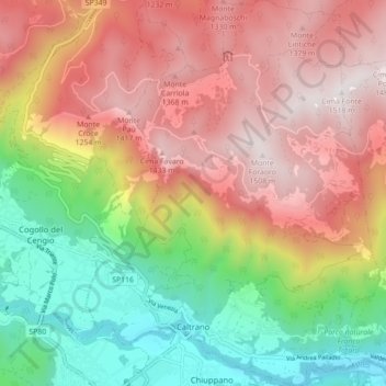
Name: Caltrano topographic map, elevation, terrain.

Location: Caltrano, Vicenza, Veneto, Italia (45.76126 11.43631 45.82243 11.50333)

Average elevation: 846 m

Minimum elevation: 165 m

Maximum elevation: 1,506 m

Gear up for your next adventure:

🔥Camping Stove - Portable stoves to cook outdoors with ease
⛺Backpacking Tent - Lightweight tent for long-distance hiking trips
🛌Down Sleeping Bag - Superior warmth-to-weight ratio for cold nights
🧤Insulated Winter Gloves - Heavy-duty protection for sub-zero Canadian adventures
🧥Softshell Jacket - Windproof and breathable jacket for hiking

As an Amazon Associate, this site earns from qualifying purchases at no extra cost to you.