Geolocate

Morinda topographic map

Click on the map to display elevation.

About this map

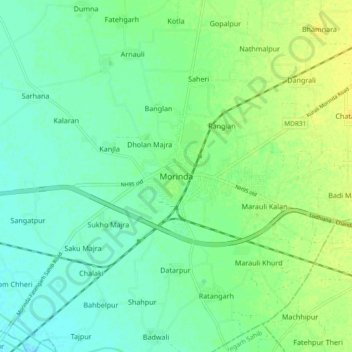
Name: Morinda topographic map, elevation, terrain.

Location: Morinda, Morinda Tahsil, Rupnagar, Punjab, 140101, India (30.75085 76.45845 30.83085 76.53845)

Average elevation: 284 m

Minimum elevation: 275 m

Maximum elevation: 295 m

Gear up for your next adventure:

🥾Trail Running Boots - Durable shoes designed for trail running
🥘Camping Cookware Set - Compact nesting pots and pans for trail cooking
Camping Coffee Maker - Brew fresh coffee anywhere on the topographic map
Camping Tent - Weather-resistant tents suitable for 2 to 6 people
👟Sport Hiking Sandals - Breathable footwear for water crossings and camp rest

As an Amazon Associate, this site earns from qualifying purchases at no extra cost to you.