
Hamar topographic map
Interactive map
Click on the map to display elevation.
About this map
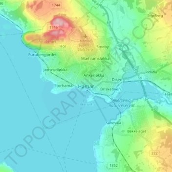
Name: Hamar topographic map, elevation, terrain.
Location: Hamar, Innlandet, 2317, Norvège (60.75485 11.02805 60.83485 11.10805)
Average elevation: 152 m
Minimum elevation: 118 m
Maximum elevation: 292 m