Geolocate

Kattur topographic map

Click on the map to display elevation.

About this map

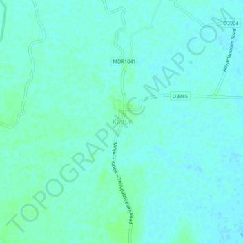
Name: Kattur topographic map, elevation, terrain.

Location: Kattur, Ponneri, Thiruvallur District, Tamil Nadu, India (13.33348 80.26417 13.37348 80.30417)

Average elevation: 4 m

Minimum elevation: 1 m

Maximum elevation: 8 m

Gear up for your next adventure:

🪑Ultralight Camping Stool - Compact seating for rest stops during long hikes
🏃Hydration Running Vest - Carry water and maps close to your body for speed
🔥Emergency Fire Starter - Reliable ignition source for all weather conditions
🧥Insulated Jacket - Keep warm in cold outdoor conditions
🥾Hiking Shoes - Durable and comfortable shoes for trail hiking

As an Amazon Associate, this site earns from qualifying purchases at no extra cost to you.