Geolocate

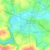
Virey topographic map

Click on the map to display elevation.

About this map

Name: Virey topographic map, elevation, terrain.

Location: Virey, Saint-Hilaire-du-Harcouët, Avranches, Manche, Normandie, France métropolitaine, 50600, France (48.55955 -1.18626 48.60772 -1.11224)

Average elevation: 99 m

Minimum elevation: 55 m

Maximum elevation: 158 m

Other topographic maps

Click on a map to view its topography, its elevation and its terrain.

Gear up for your next adventure:

⛺Lightweight Backpacking Tent - Compact tent for efficient hiking trips
🥽Outdoor Goggles - Protective eyewear for outdoor activities
🧴First Aid Kit - Essential first aid supplies for outdoor emergencies
🏕️Camping Hammock - Integrated protection for sleeping between trees
🛏️Sleeping Bag - Warm and compact sleeping bags for outdoor camping

As an Amazon Associate, this site earns from qualifying purchases at no extra cost to you.