Geolocate

Punta Razil topographic map

Click on the map to display elevation.

About this map

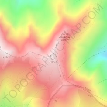
Name: Punta Razil topographic map, elevation, terrain.

Location: Punta Razil, Bagnolo Piemonte, Cuneo, Piedmont, Italy (44.72645 7.19894 44.72655 7.19904)

Average elevation: 2,008 m

Minimum elevation: 1,417 m

Maximum elevation: 2,393 m

Gear up for your next adventure:

🪑Insulated Seat Pad - Protect your seat from cold rocks and wet logs
🔦LED Flashlight - Powerful and long-lasting flashlight for camping and emergencies
🦶Hiking Shoe Insoles - Added support for high arches and long days on feet
🧥Ultralight Puffy Jacket - Maximum warmth that packs down to the size of an orange
🥾Waterproof Hiking Boots - Essential footwear for rugged terrain and wet Canadian trails

As an Amazon Associate, this site earns from qualifying purchases at no extra cost to you.