
Pingle topographic map
Click on the map to display elevation.
About this map
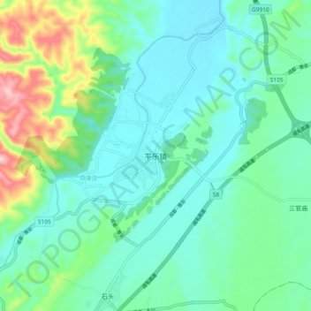
Name: Pingle topographic map, elevation, terrain.
Location: Pingle, Sichuan, China (30.30787 103.29733 30.38787 103.37733)
Average elevation: 585 m
Minimum elevation: 516 m
Maximum elevation: 823 m
Other topographic maps
Click on a map to view its topography, its elevation and its terrain.
Liangshan Yi Autonomous Prefecture
Owing to its low latitude and high elevation, Liangshan has a mild climate. Under the Köppen system, the prefecture belongs to the humid subtropical zone (Köppen Cwa). Winters feature mild days and cool nights, while summers are very warm and humid. Monthly daily mean temperatures range from 9.6 °C (49.3…
Average elevation: 2,439 m