Geolocate

Moradabad topographic map

Click on the map to display elevation.

About this map
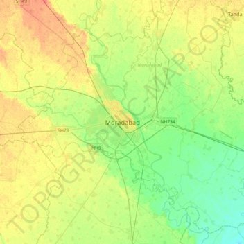
Name: Moradabad topographic map, elevation, terrain.

Location: Moradabad, Uttar Pradesh, 244001, India (28.67350 78.61329 28.99350 78.93329)

Average elevation: 198 m

Minimum elevation: 181 m

Maximum elevation: 219 m

Gear up for your next adventure:

🧰Multitool Knife - Compact and versatile tool for outdoor use
🥾Hiking Boots - Sturdy boots providing ankle support and traction on rugged trails
🦟Insect Repellent - Keep mosquitoes and black flies away in wooded areas
🥽Outdoor Goggles - Protective eyewear for outdoor activities
🏃Hydration Running Vest - Carry water and maps close to your body for speed

As an Amazon Associate, this site earns from qualifying purchases at no extra cost to you.