Geolocate

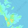
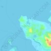
Pulau Bulan topographic map

Click on the map to display elevation.

About this map

Name: Pulau Bulan topographic map, elevation, terrain.

Location: Pulau Bulan, Batam, Riau Islands, Sumatra, Indonesia (0.90966 103.83134 1.03784 103.96778)

Average elevation: 6 m

Minimum elevation: -2 m

Maximum elevation: 177 m

Other topographic maps

Click on a map to view its topography, its elevation and its terrain.

Pulau Rempang

Indonesia > Riau Islands > Batam

Average elevation: 7 m

Baloi

Indonesia > Riau Islands > Batam

Average elevation: 24 m

Sungai Gong

Indonesia > Riau Islands > Batam

Average elevation: 15 m

Bengkong Indah

Indonesia > Riau Islands > Batam

Average elevation: 17 m

Villa Pesona Asri

Indonesia > Riau Islands > Batam > Griya KPN

Average elevation: 22 m

Tiban Indah

Indonesia > Riau Islands > Batam

Average elevation: 19 m

Duta Mas

Indonesia > Riau Islands > Batam > Baloi Permai

Average elevation: 19 m

Tanjung Pinggir

Indonesia > Riau Islands > Batam

Average elevation: 6 m

Lubuk Baja Kota

Indonesia > Riau Islands > Batam

Average elevation: 18 m

Teluk Tering

Indonesia > Riau Islands > Batam

Average elevation: 14 m

Gear up for your next adventure:

🥾Light Trekking Boots - Supportive boots for multi-day treks
🧴Insect Repellent - Protect yourself from bugs during outdoor adventures
🛶Kayak Dry Bag - Waterproof storage for kayaking adventures
🧦Outdoor Socks - Durable socks designed for hiking and outdoor sports
🥾Hiking Gaiters - Protect legs and shoes from mud, snow, and debris

As an Amazon Associate, this site earns from qualifying purchases at no extra cost to you.