Geolocate

Mainit topographic map

Click on the map to display elevation.

About this map

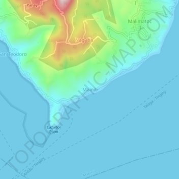
Name: Mainit topographic map, elevation, terrain.

Location: Mainit, Mabini, Batangas, Calabarzon, 4202, Philippines (13.67168 120.88128 13.71168 120.92128)

Average elevation: 66 m

Minimum elevation: 0 m

Maximum elevation: 451 m

Gear up for your next adventure:

🧥Thermal Fleece Jacket - Versatile insulation for changing mountain temperatures
❄️Traction Ice Cleats - Slip-on spikes for icy trails and winter hiking
🥾Trail Running Shoes - Lightweight and durable shoes for trail running
🔦LED Headlamp - Hands-free lighting for early morning starts or late finishes
🔭Compact Binoculars - Lightweight optics for scouting trails and wildlife

As an Amazon Associate, this site earns from qualifying purchases at no extra cost to you.