Geolocate

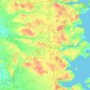
Tønder topographic map

Click on the map to display elevation.

About this map
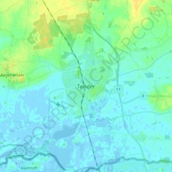
Name: Tønder topographic map, elevation, terrain.

Location: Tønder, Tønder Municipality, Region of Southern Denmark, 6270, Denmark (54.89806 8.82294 54.97806 8.90294)

Average elevation: 5 m

Minimum elevation: -4 m

Maximum elevation: 20 m

Other topographic maps

Click on a map to view its topography, its elevation and its terrain.

Funen

Denmark > Region of Southern Denmark

Average elevation: 19 m

Funen

Denmark > Region of Southern Denmark

Average elevation: 19 m

Funen

Denmark > Region of Southern Denmark

Average elevation: 19 m

Rømø

Denmark > Region of Southern Denmark

Average elevation: 0 m

Funen

Denmark > Region of Southern Denmark

Average elevation: 19 m

Skarø

Denmark > Region of Southern Denmark

Average elevation: 0 m

Guldbjerg

Denmark > Region of Southern Denmark

Average elevation: 23 m

Egholm

Denmark > Region of Southern Denmark

Average elevation: 0 m

Funen

Denmark > Region of Southern Denmark

Average elevation: 19 m

Ærø

Denmark > Region of Southern Denmark

Average elevation: 3 m

Funen

Denmark > Region of Southern Denmark

Average elevation: 19 m

Gear up for your next adventure:

🥾All-Terrain Hiking Boots - Versatile boots for varied hiking conditions
💡Compact LED Flashlight - Powerful and portable flashlight for outdoor use
🧥Softshell Hiking Jacket - The perfect balance of wind protection and breathability
🚑Survival Whistle - Signal for help across long distances in mountains
🧴Outdoor Sunscreen - High SPF protection for high-altitude UV exposure

As an Amazon Associate, this site earns from qualifying purchases at no extra cost to you.