Geolocate

Bavla topographic map

Click on the map to display elevation.

About this map

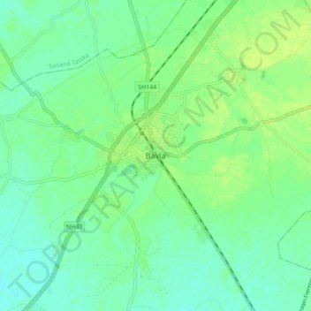
Name: Bavla topographic map, elevation, terrain.

Location: Bavla, Bavla Taluka, Ahmedabad, Gujarat, 382220, India (22.78789 72.32847 22.86789 72.40847)

Average elevation: 26 m

Minimum elevation: 19 m

Maximum elevation: 32 m

Gear up for your next adventure:

🥾Mountaineering Boots - Supportive boots for climbing and high-altitude hiking
🔋Lithium AA Batteries - Long-lasting power that performs in extreme cold
🔭Compact Monocular - One-handed bird watching and trail spotting
💡Solar Camping Lamp - Eco-friendly lighting for campsites
🥾Hiking Boots - Sturdy boots providing ankle support and traction on rugged trails

As an Amazon Associate, this site earns from qualifying purchases at no extra cost to you.