
Thank you for supporting this site ❤️
Make a donation
Make a donation
Gear up for your next adventure:
As an Amazon Associate, this site earns from qualifying purchases at no extra cost to you.
Africo topographic map
Click on the map to display elevation.
Thank you for supporting this site ❤️
Make a donation
Make a donation
Gear up for your next adventure:
As an Amazon Associate, this site earns from qualifying purchases at no extra cost to you.
About this map
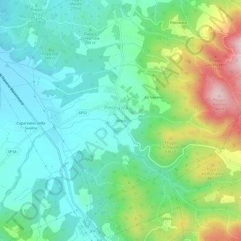
Name: Africo topographic map, elevation, terrain.
Location: Africo, Pievescola, Casole d'Elsa, Siena, Toskana, Italien (43.28801 11.11242 43.32801 11.15242)
Average elevation: 322 m
Minimum elevation: 214 m
Maximum elevation: 587 m
Thank you for supporting this site ❤️
Make a donation
Make a donation
Gear up for your next adventure:
As an Amazon Associate, this site earns from qualifying purchases at no extra cost to you.